
Green Boundaries
Green Infrastructure (GI) plays a vital role in NYC’s stormwater management system, yet many dog walkers struggle to identify these zones in daily routes. This often leads to accidental intrusion and pet waste that compromise GI’s ecological function. Through field research, surveys, and rapid prototyping, this project explores how environmental UX and micro-interactions can help dog walkers intuitively recognize and avoid GI areas. The outcome is a sensor-triggered awareness concept that highlights the boundary of GI spaces, demonstrating how subtle, human-centered cues can support urban sustainability and encourage more mindful public behaviors.
Role
UX Designer & Researcher
Project Type
Group Project
Timeline
Nov–Dec 2025
Tool Used


Project Context
Graduate Coursework
Design Process

Background & Context
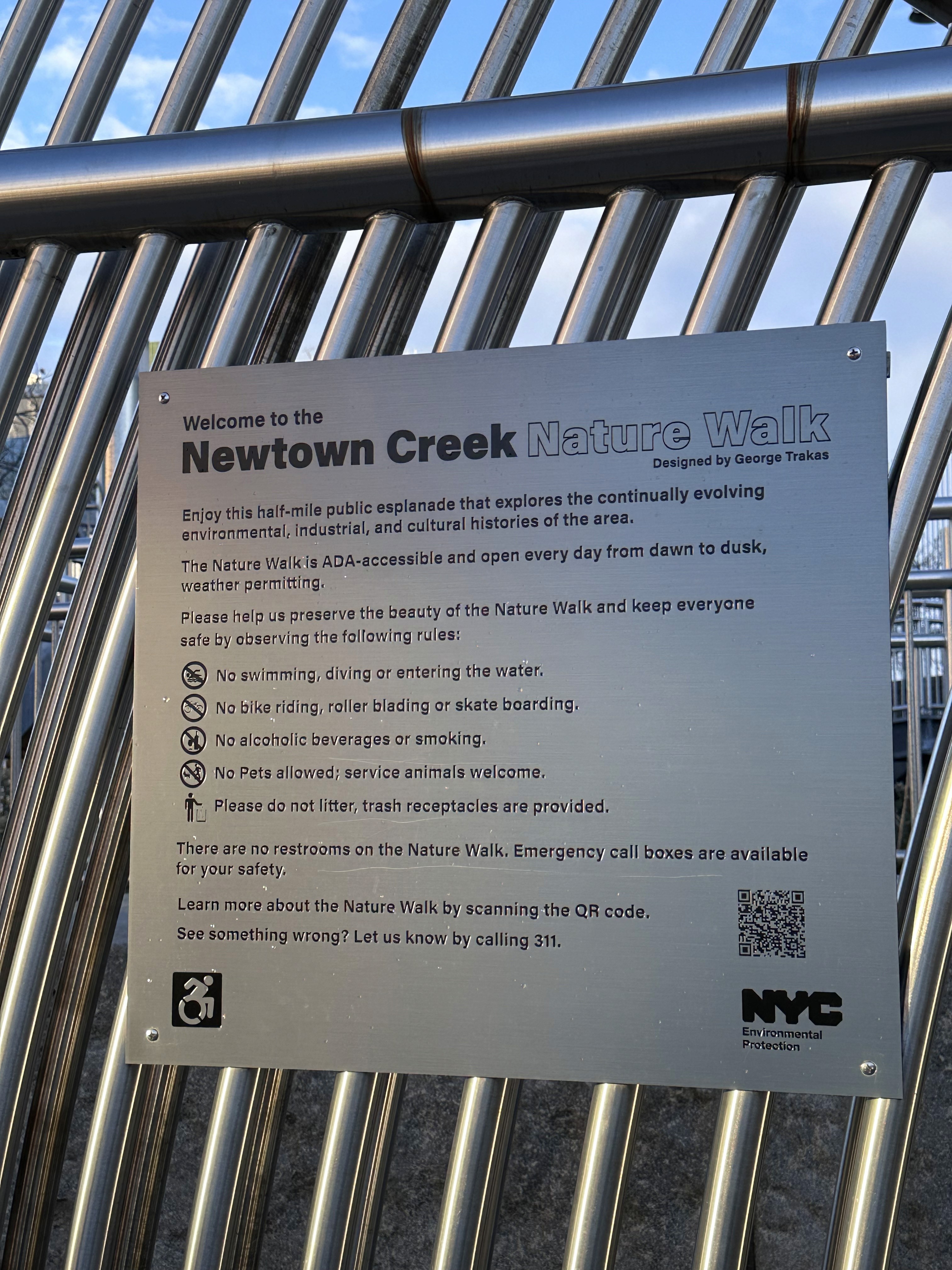
This project was inspired by my visit to the Newton Creek Nature Walk – one of New York’s largest and most iconic Green Infrastructure (GI) sites. During the trip, I noticed a clear “No Pets Allowed” sign at the entrance. However, despite the prohibition, most visitors were dog walkers casually strolling through the space.

Curious about how widespread GI is across the city, I explored NYC’s official Green Infrastructure interactive map and discovered more than 1,000 bioswales and greenstreets embedded into everyday sidewalks and residential neighborhoods. Many of these GI installations are designed to blend seamlessly into their surroundings, which led me to further investigate how the public encounters, understands, and interacts with GI in daily life.


Research Insights
Field Observation
We conducted a field observation of the GI located near 243 Nostrand Ave.


There were quite a few dog walkers in this area.
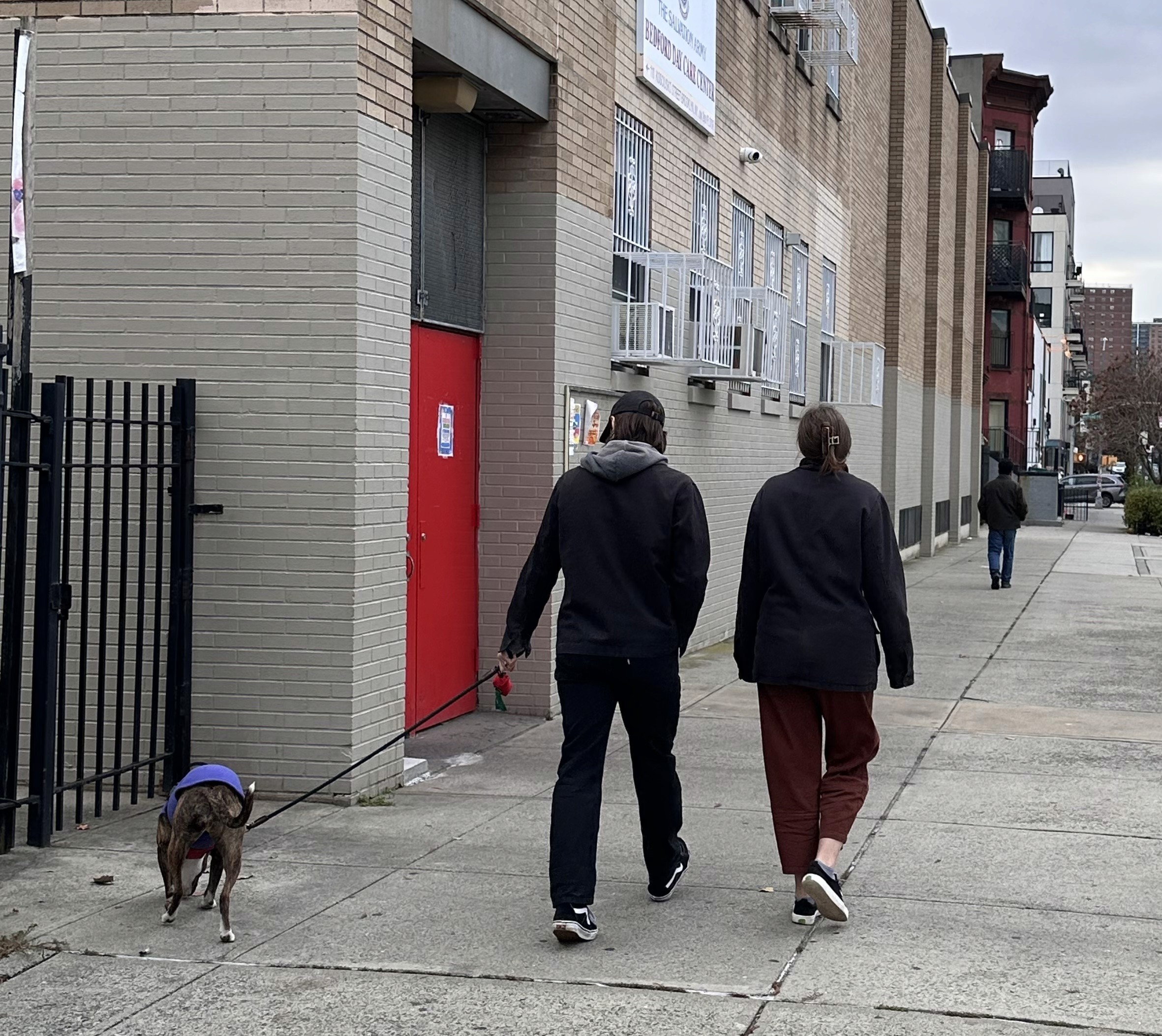
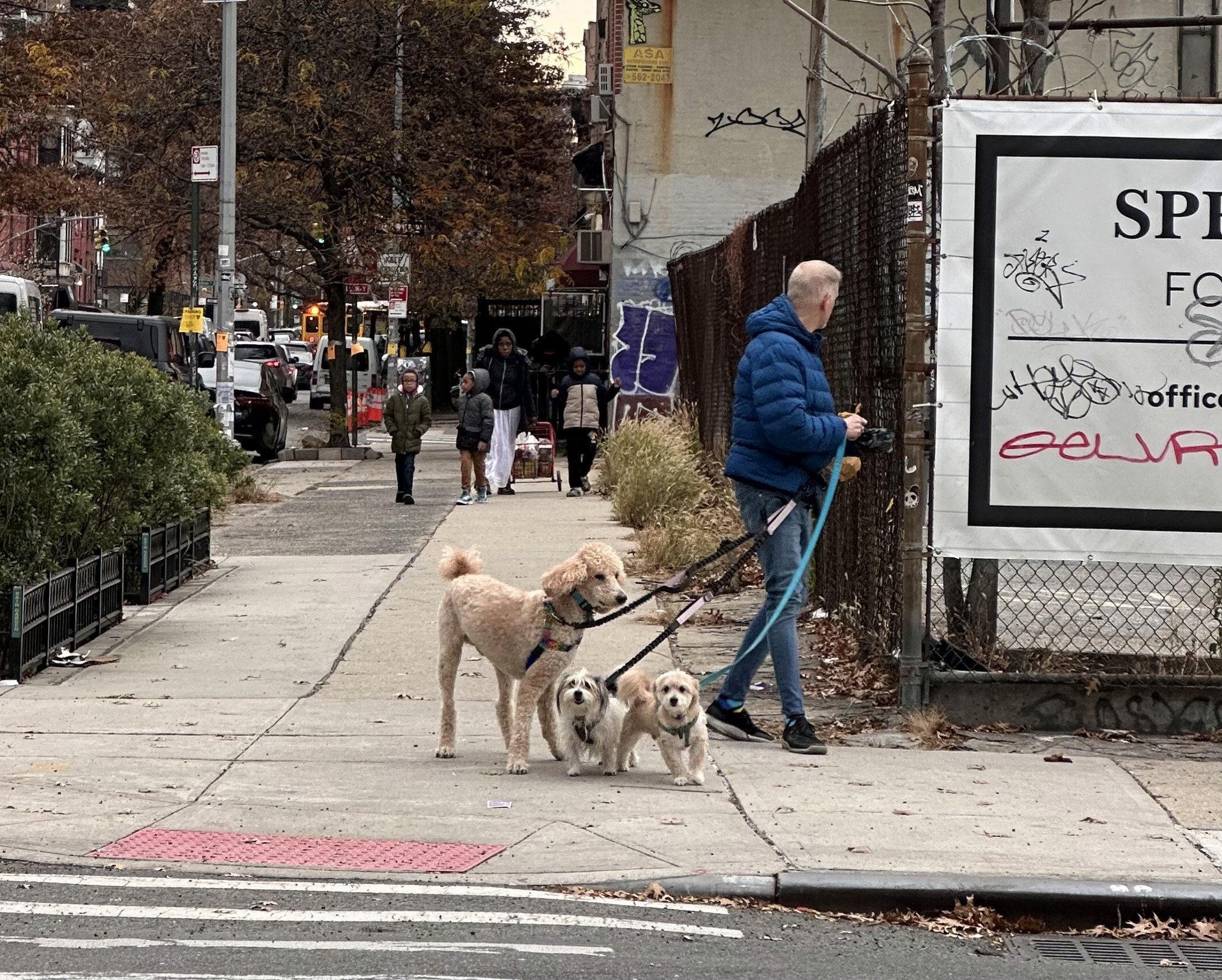
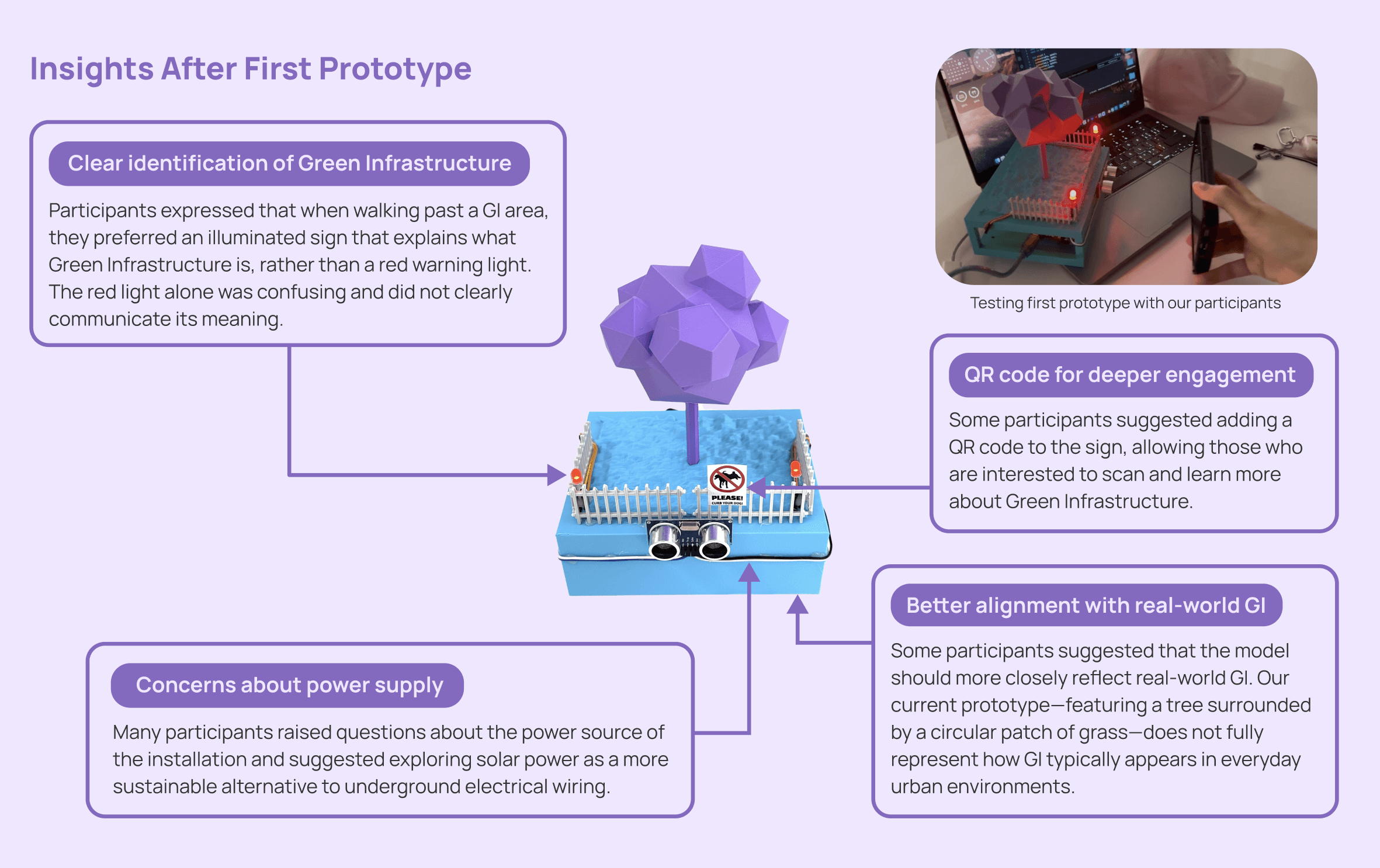
GI boundaries blend in as regular fencing, which makes them easy to miss during dog walks.
Existing GI signage is either overly technical or not visible at eye level.
GI has different types: rain gardens, green roofs, bioswales, tree & planter boxes etc.
B. Secondary Research: Why Dogs Are Restricted in GI Areas
Environmental studies (Evaluating the effects of canine urine on urban soil microbial communities) indicate that canine urine significantly reduces soil microbial diversity and water infiltration, directly weakening Green Infrastructure’s stormwater performance.
C. Survey Findings
The survey uncovered a disconnect between environmental regulations and how dog walkers perceive GI spaces.


UX Problem Statement
Dog walkers in NYC often cannot clearly identify where Green Infrastructure (GI) areas are located due to unclear boundaries and insufficient signage. As a result, pets may accidentally enter GI zones or urinate in these ecological installations, causing damage and reducing their environmental function. There is a need for a clearer, more accessible way for dog walkers to recognize and avoid GI spaces during daily routines.
User Insight: Preference for Interactive Cues
We conducted follow-up interviews with survey participants. Many interviewees expressed a strong preference for interactive, light-based signage as a more intuitive way to communicate GI boundaries and rules while walking their dogs.

Translating the HMW into Physical Concepts
Early Physical Prototyping
Two initial concepts were explored: a miniature mockup and a physical sign. Through team discussions and early evaluation, the miniature mockup emerged as the more intuitive approach, as it allowed users to immediately understand spatial relationships and interaction cues within Green Infrastructure environments.


Post-Prototype Usability Testing
After the first prototype, we followed up with our survey participants to gather feedback on the design. Several key insights emerged:
Refined Design Proposal
Refined Draft based on the insights

AI-Assisted Concept Render
Proposed Technical Implementation


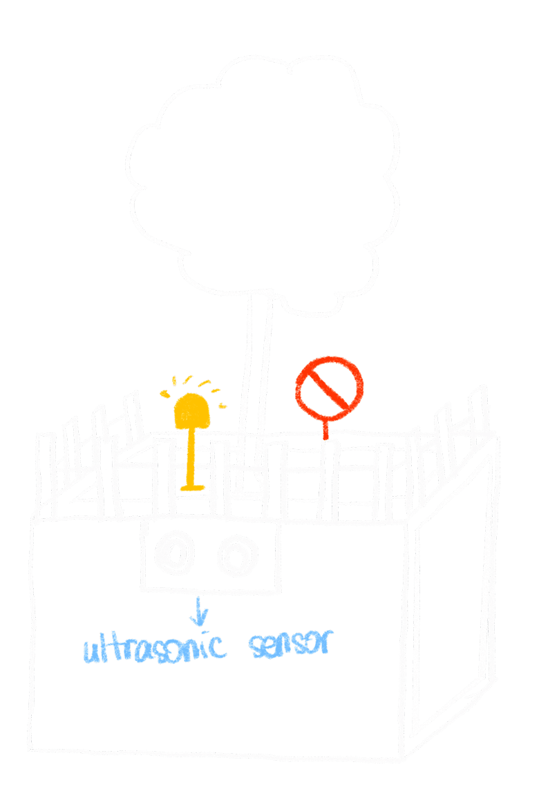
The system is designed to be implemented using a Time-of-Flight distance sensor to detect pedestrians passing by the sign, triggering an interactive response. A NeoPixel LED stick is proposed to provide subtle visual feedback when the system is activated.
An Arduino Nano is selected for its compact size and suitability for embedded urban installations. The system is designed to be powered by a solar panel, enabling off-grid deployment and long-term sustainability in public spaces.
Due to time constraints, a fully fabricated physical prototype was not completed. However, the sensing logic, hardware components, and interaction flow have been fully defined and validated through design iteration and visualization.
